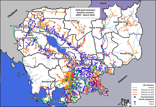
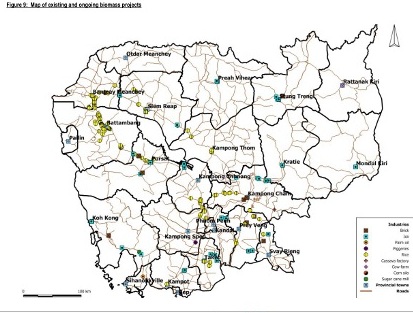
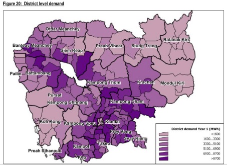
CCDE can provide assistance through various technical tools and technologies
1- Geographic Information Systems (GIS)
CCDE has developped a comprehensive and national GIS database which was widely used in the past in our projects for various purposes. Several geospatial analysis can be done using criteria such as :
• The number of the village
• Road conditions (in every season or not, paved or not)
• The number of inhabitants per village
• The number of men and women per village
• Are they connected or not electricity
• On average each village how many cows per family
CCDE can therefore extract various data according to a number of parameters defined and establish precise and customized maps


2- Geospatial planning
Through GEOSIM, the specialized geospatial planning tool developped by IED, CCDE can identify and run senario for the develment of electricity at provincial or national level identifying opportunities for development of mini grids, renewable energy projects of distributed energy systems (SHS)

3- Strategic tools and capacity building
CCDE can accompagny clients providing specialized and customized capacity building along with their acquisition of specialized tools in the energy sector working in close collaboration with IED's catalogue of tools (www.ied-sa.com)

